BY INDUSTRY
Deliver better risk analytics with high-quality climate and environmental peril data.
Climate-related risks such as wildfire, flooding, and severe weather threaten the viability of the insurance business in an increasing number of markets. InsurTech providers are scrambling for more accurate data to effectively model these threats and deliver better information to carriers. That’s where Teren comes in.
Take the Guesswork out of Wildfire Risk Assessment
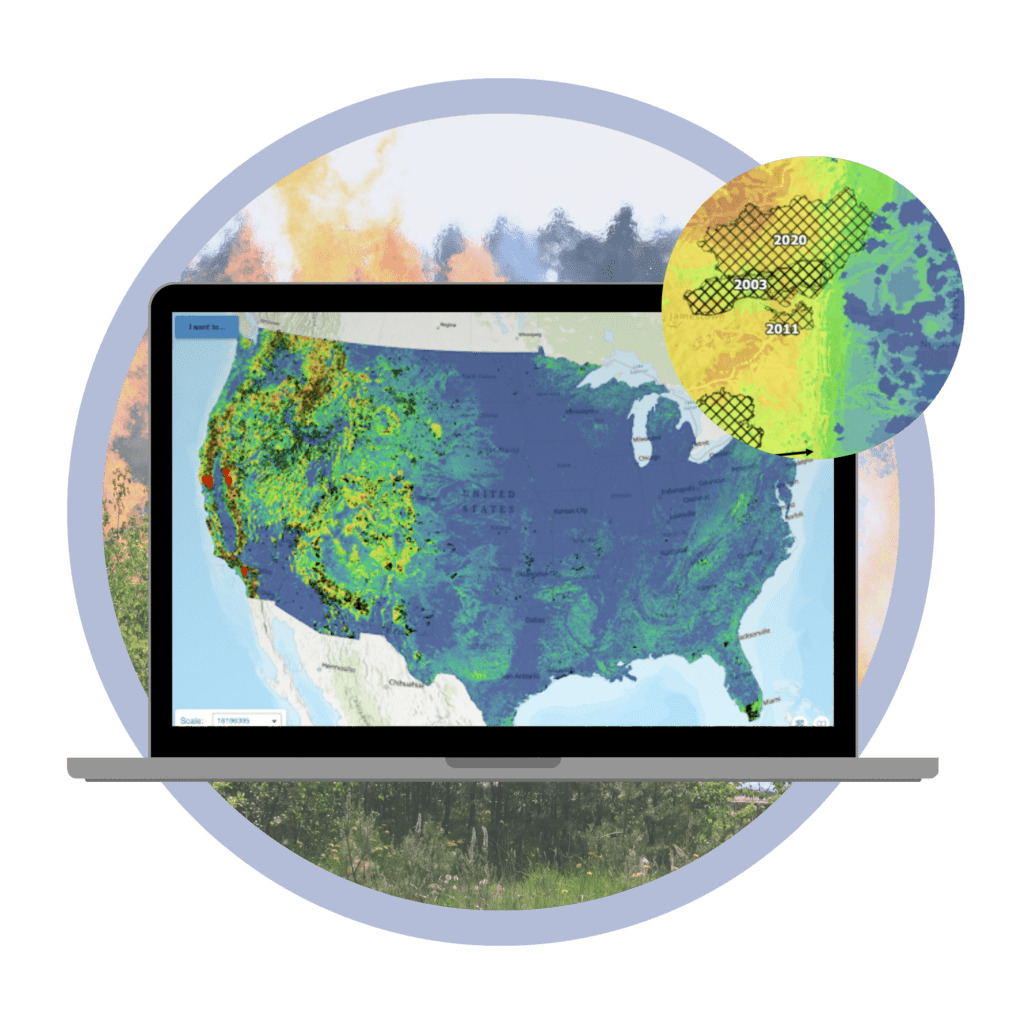
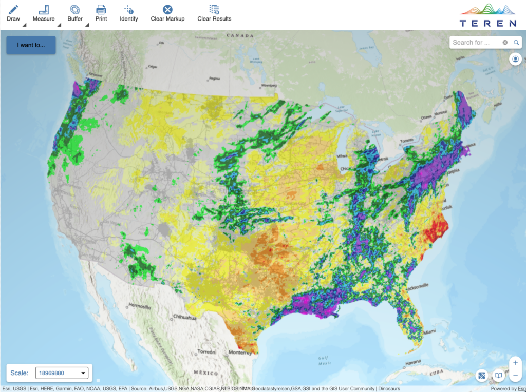
Confidently Assess Wildfire Risk Across the United States
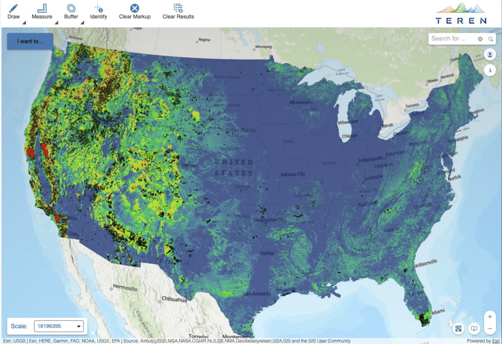
Teren’s nationwide wildfire potential model is rooted in ecosystem science to provide a more granular understanding of wildfire exposure throughout the coterminous United States. Unlike other models, Teren’s wildfire potential model is high-resolution, statistically validated and scientifically informed to better understand and evaluate wildfire risk.
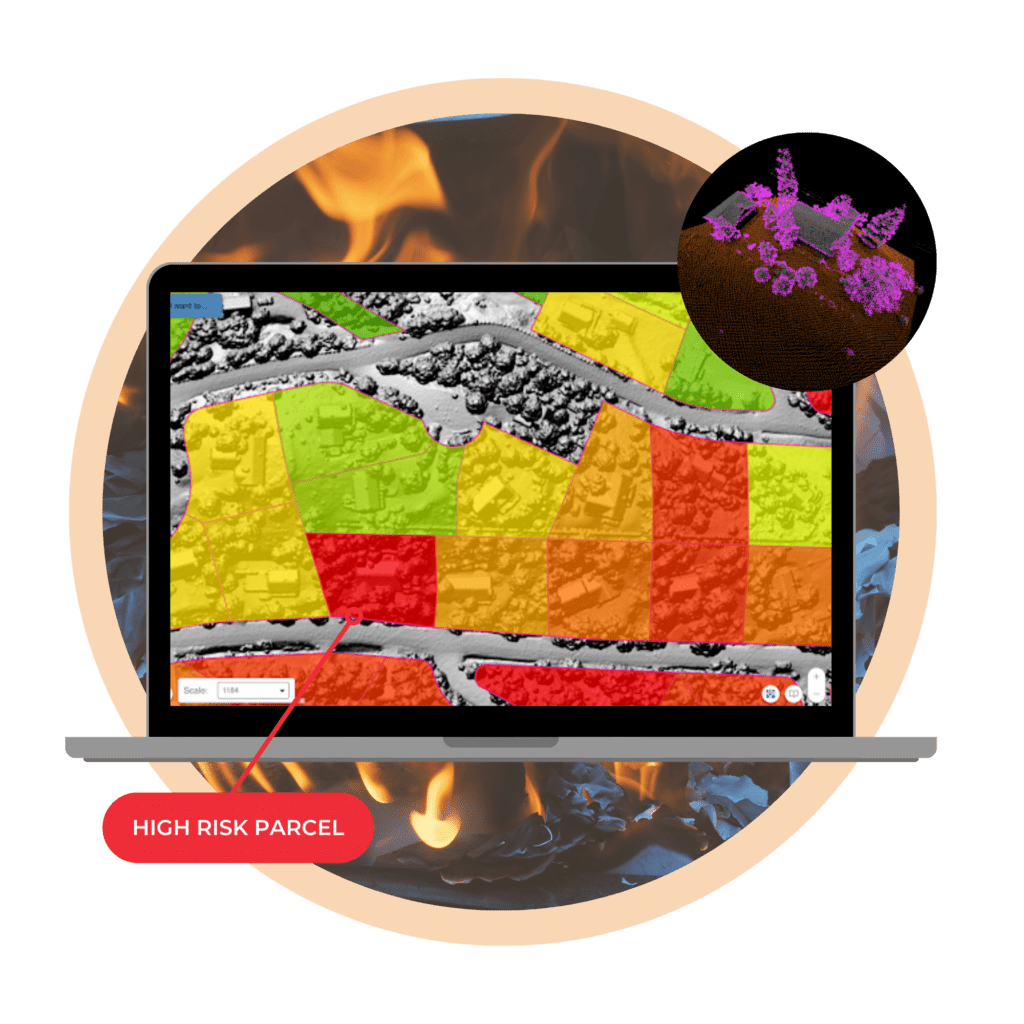
PRECISION MAKES THE DIFFERENCE
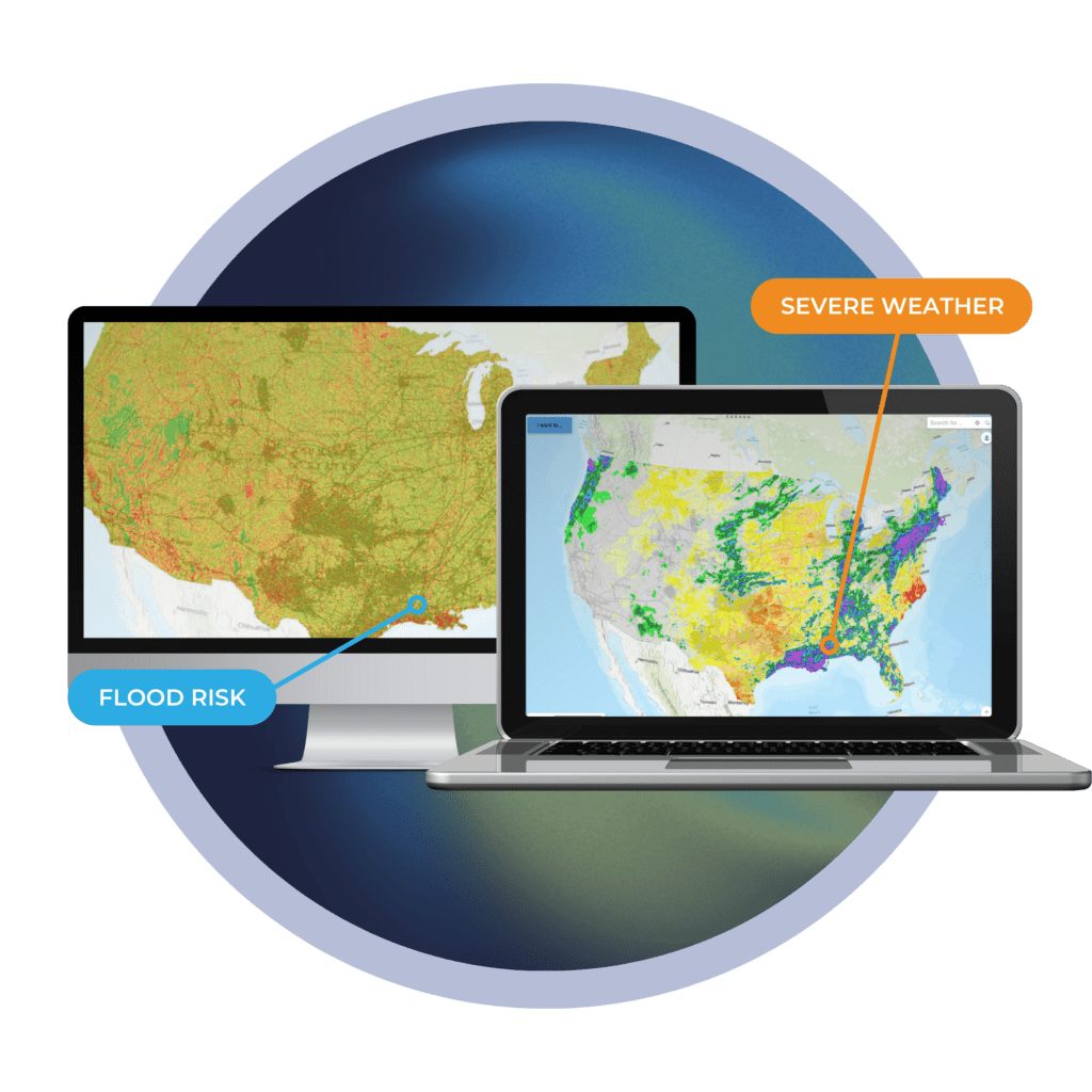
Pinpoint Risk at the Property Level
Broad risk models are driving insurers out of markets prone to wildfire and flooding. With Teren, risk analysts can pinpoint threats at the property level to more accurately analyze exposure and potential loss.
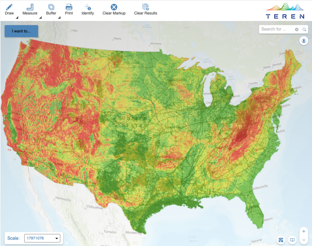
Statistically Validated, Scientifically Informed, High-Resolution Data to Better Evaluate Exposures
Access Teren’s Nationwide Hazard Models to better understand wildfire, weather, and other climate risks.
Wildfire Threat Model
Severe Weather
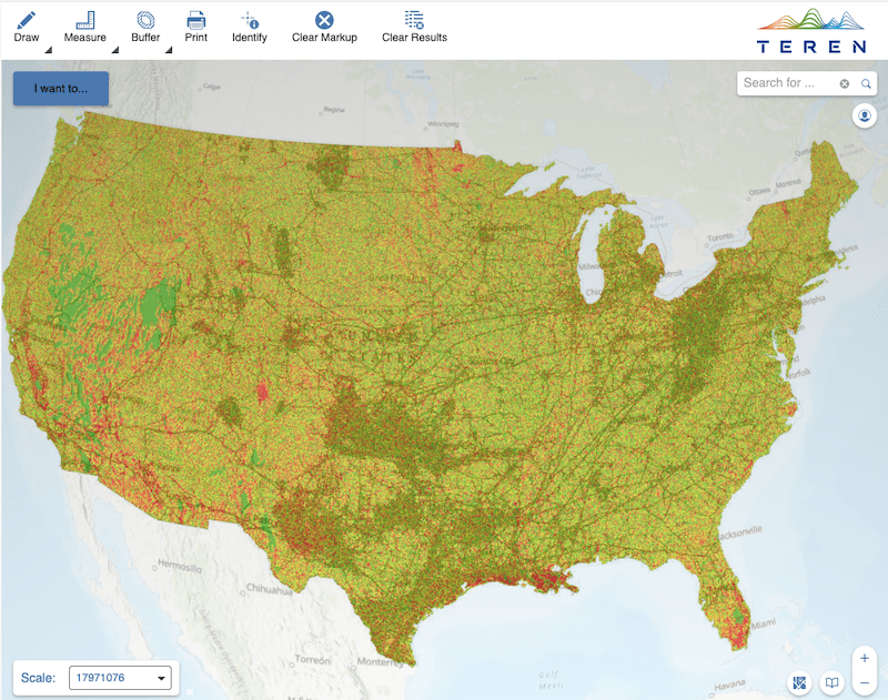
Flooding Risk
Landslide Threat
Teren’s Wildfire Data is Available Three Ways
Teren delivers the wildfire threat potential layer directly to insurers and brokers via API or software integration.
Request MeetingTeren’s wildfire potential model is available as a part of EigenRisk’s Catastrophe Risk Management Platform.
Visit EigenRiskTeren’s wildfire potential model is available as a part of Ping Data Intelligence SOV Ingestion Software.
Visit Ping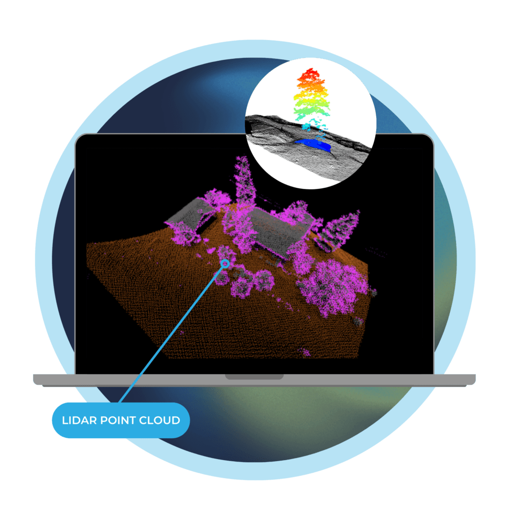
The future belongs to those who are fast
Powerful Processing Delivers Remotely-Sensed Data to InsurTech
Teren is solving today’s challenges of working with remotely-sensed data by leveraging the processing speed of the future. We accelerate insuretech’s path to delivering greater customer value with a new standard for 3D data processing at speed and scale.
SEVERE WEATHER REPORTING
Examine Conditions that Increase Exposure
Severe weather can escalate flood risk in a matter of minutes. With Teren, your clients can keep a pulse on changing conditions that could impact covered properties by monitoring weather deviations from historical norms.