Consistent, high-quality spatial analytics in days, not weeks.
Accurate
Teren uses high-fidelity LiDAR for accurate analysis.
Expert-approved
Access data curated by data scientists, without the costs of hiring one.
Scalable
Hydrology, terrain & vegetation intelligence at scale.
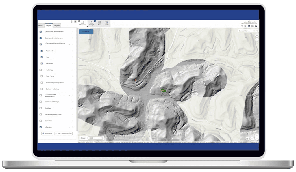
Identify, prioritize & monitor landslides
In steep and hilly terrain, geohazards and landslides manifest as the result of changes in vegetation, hydrology, and land movement.
Teren proactively identifies, ranks, and monitors landslide geohazards to create effective response and mitigation plans for pipeline operators and DOT’s.