Announcing Our Strategic Collaboration with Woolpert

When you set out to be the best at providing accurate, timely and actionable environmental intelligence, you want to align yourself with companies who share the same values. Woolpert, a global leader in data acquisition, was an early data provider for Teren. Over the years, it became clear to our teams and theirs that there […]
Teren Joins the Colorado-Wyoming Climate Resilience Engine Digital Twin Accelerator

Teren has been selected to participate in the inaugural Colorado-Wyoming Climate Resilience Engine Digital Twin Accelerator, a pioneering program designed to accelerate startups utilizing digital twin technology for climate resilience. This program, backed by a coalition of corporate, governmental, and research partners, offers unparalleled access to resources that will enhance Teren’s ability to drive innovation […]
Teren Launches Terevue to Revolutionize Environmental Risk Management for Infrastructure Operators With Real-time Geospatial Intelligence

New SaaS Product Is the First and Only Technology Offering System-wide Intelligent Alerting of Potential Environmental Hazard Events on Critical Infrastructure. DENVER, COLORADO, March 5th, 2025 (BUSINESSWIRE) — Teren, a leader in geospatial intelligence, is proud to announce the launch of Terevue, a groundbreaking cloud-based environmental intelligence platform that empowers pipeline operators and infrastructure managers […]
Spooky Sightings from Above: Our Favorite Haunted Data Sets

Mappy Halloween from Teren! This October, we’re celebrating the spooky side of geospatial data. From the mapping of haunted sites around the world, to geospatial investigations of the paranormal. Check out our favorite picks below and get mapping! The Spookiest Places in the U.S. (and the Least Spooky) To look at how spooky U.S. metro […]
Introducing Teren’s Bi-Weekly Live Demos: Your Gateway to Advanced Environmental Intelligence

We’re excited to announce the launch of Teren’s bi-weekly live product tours! These live demos are designed to help you get the most out of Teren’s cutting-edge data suites, guiding you through the platform with real-time examples, practical advice, and answers to your pressing questions. Whether you’re just starting to explore Teren’s environmental intelligence capabilities […]
Teren at the Society of American Foresters National Convention: Empowering Conservation with Geospatial Intelligence
We’re excited to announce that Teren will be attending this year’s Society of American Foresters (SAF) National Convention, taking place in Loveland, CO from September 17-20, 2024. As leaders in geospatial data innovation, we’re eager to connect with land and water resource managers, emergency watershed protection coordinators, and others dedicated to stewarding natural resources. Visit […]
Denver’s Energy Tech Community: Alive and Thriving
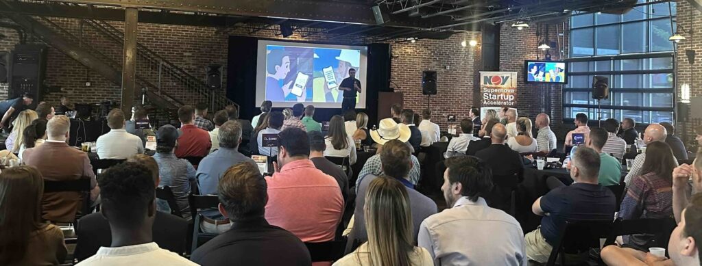
Whoever said energy and tech don’t mix (…guilty?) was mistaken. Teren was invited to pitch at Digital WildCatter‘s Denver Energy Tech Night at Mile High Station on July 11th. The event invites energy startups to present and go head to head in a tech pitch showdown. I had the opportunity to present for team Teren, focusing on our […]
Managing pipeline integrity on the inside and out: Teren and pipelinelogic’s synergistic energy partnership
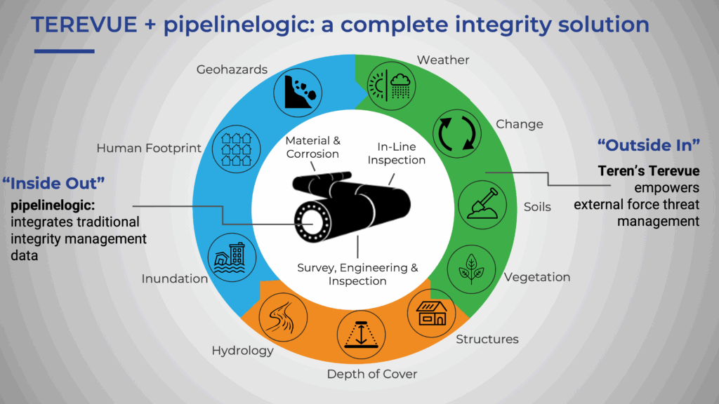
Preparations for Teren and pipelinelogic‘s shared presence at the upcoming Esri Energy Resources GIS Conference (ERGIS) next April 24-25, 2024, deemed a perfect moment to look back and reflect this partnership which began in 2023. In the dynamic landscape of the energy industry, innovation is not just an option; it’s a necessity. As regulatory demands […]
Enhancing Pipeline Safety: Integrating Digital Twins and Geohazard Modeling
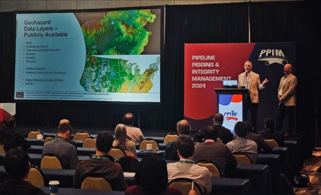
At PPIM 2024, Teren was part of a collaborative presentation that detailed a groundbreaking approach to bolster the safety and resilience of critical energy infrastructure.
GeoWeek Recap: AI & Machine Learning Opportunities for Geospatial Data

During GeoWeek, our CEO, Toby Kraft, was a guest speaker in the AI and Machine Learning Opportunities for Geospatial Data track.