What Makes a Good Hazard Model for Critical Infrastructure Operations? 6 Questions to Ask

Hazard models are everywhere, from FEMA flood maps to state landslide inventories to national wildfire indices. But not all models are created equal. For infrastructure operators (be it pipelines, utilities, transportation, renewables and beyond), integrity engineers, and damage prevention teams, these models directly influence decisions on where to deploy crews, how to prioritize integrity management […]
Wildfire Ready: How the USDA-NRCS Is Using Environmental Intelligence to Prioritize Forest and Rangeland Resilience

Introduction With over 500 million acres of U.S. grazing lands under growing wildfire pressure, the USDA Natural Resources Conservation Service (NRCS) is advancing innovative strategies to address these challenges. Through the Rangeland and Forestland Fuel Management Hazard Zone Prioritization for Conservation Treatments project, commonly known as “NRCS Wildfire Ready,” the agency is piloting a scalable […]
From Backlog to Back-on-Track: Automating Solar Site Pre-Screening & Processing with Teren’s Hydrology/Veg Intelligence (Customer Story)
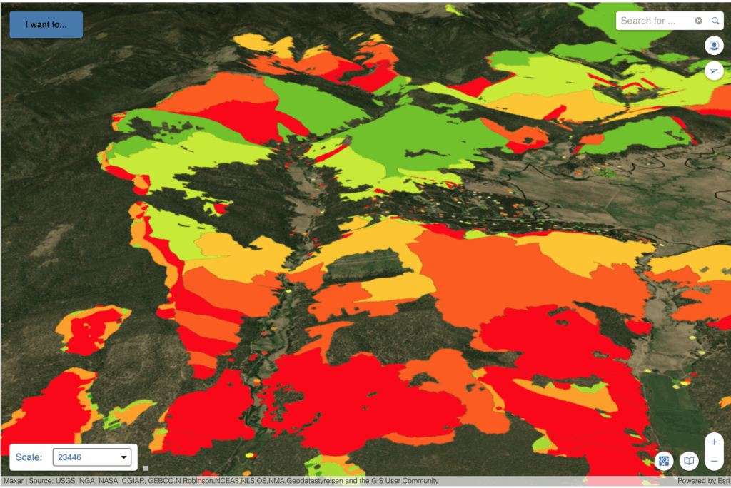
The Problem Renewable energy suppliers are in a race to efficiently and accurately identify viable solar sites around the world. Often, the best sites are already taken and developed – the remaining sites are often riddled with risk potential that needs to be carefully assessed before investing precious time and resources. In this competitive renewable screening […]
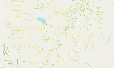
Strange Bumps in the DTM: How Teren’s LiDAR Analytics Helped A Renewable Energy Investor See the True Terrain
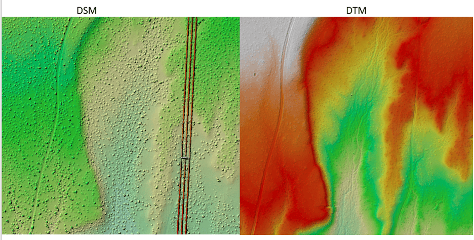
We think there are holes in the digital terrain model. That’s what an engineering firm flagged to Teren’s customer, a renewable energy investor, when they received Teren’s advanced LiDAR and analytics for a project on a solar generation facility out in Southeast New Mexico. Teren’s work with the renewable energy investor started early 2024 to […]
Understanding Post-Wildfire Hazards & Insurance Implications: A Conversation with Leading Geomorphologist John Norman

As wildfires like the recent ones in Los Angeles become increasingly prevalent across our landscapes, understanding their long-term impacts becomes crucial for land managers and insurance providers alike. We sat down with Teren’s John Norman, a geomorphologist with over two decades of experience studying post-wildfire landscapes, to discuss the critical risks and considerations facing professionals […]
Building Transportation Resilience: 5 Key Analytics to Manage Increasing Environmental Threats
In today’s rapidly changing climate, transportation infrastructure faces growing challenges from environmental and climate-related hazards. Roads, highways, railways, and critical transit corridors are increasingly vulnerable to extreme weather events, shifting climate patterns, and other environmental risks. Addressing these risks requires a robust suite of advanced analytics to inform proactive planning, prioritize investments, and support resilient […]
Transforming Well Pad Reclamation in Colorado’s DJ Basin

Learn how a major oil and gas producer has leveraged Teren’s environmental intelligence to become a leader in well pad reclamation. The Challenge: Well Pad Reclamation is a Complex, Regulated Landscape Well pad reclamation in Colorado’s Denver-Julesburg (DJ) Basin involves intricate processes and strict regulations. Companies acquire numerous assets over the years, and then often […]
10 Game-Changing Analytics for Modern Forestry and Land Stewardship

In the ever-evolving field of land and forestry management, the ability to analyze and interpret data has become crucial for sustainable decision-making. With the integration of advanced analytics, professionals can now monitor and manage natural resources more effectively, ensuring that forests and openlands are preserved for future generations. Here, we explore 10 key analytics shaping […]
Policy Update: Two Major Legislative Wins for Wildfire Technology & Management
The wildfire management policy landscape is evolving rapidly with two recent significant legislative advancements at State (Colorado) and Federal levels, aimed at enhancing technology deployment and collaboration in wildfire prevention and mitigation. Bills recently approved by Colorado’s Wildfire Review Committee, and the Federal HR8790 Fix Our Forests Act are exciting developments that offer unique opportunities […]
From Polar Bears to Landslides: A Geomorphologist’s Quest to Solve Nature’s Greatest Mysteries Through Soil

In his 25+ years as a geomorphologist, soil scientist and quantitative spatial ecologist, John Norman has navigated the realms of the impossible more than once. From predicting landslide risks to studying soil moisture, his journey has been one of transforming once “impossible” tasks into actionable science. But one project stands out: the time he was […]