Introduction

With over 500 million acres of U.S. grazing lands under growing wildfire pressure, the USDA Natural Resources Conservation Service (NRCS) is advancing innovative strategies to address these challenges. Through the Rangeland and Forestland Fuel Management Hazard Zone Prioritization for Conservation Treatments project, commonly known as “NRCS Wildfire Ready,” the agency is piloting a scalable geospatial and remote sensing framework to help prioritize conservation treatments for wildfire risk reduction across the West.
Delivered in partnership with Teren and the University of Arizona, and supported under the NRCS Conservation Effects Assessment Project – Grazing Lands (CEAP-GL), this pilot effort combines high-resolution data, advanced modeling, and machine learning to support proactive wildfire mitigation and post-fire watershed protection.
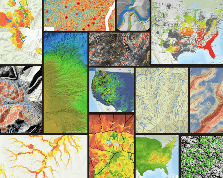
Mapping Fuels with Precision
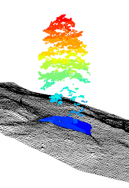
Using 15-cm resolution aerial imagery and 20 pts/m² LiDAR, Teren performed individual tree segmentation across over one million acres in California, Colorado, and New Mexico. Each of the 81+ million trees identified was measured and classified by biomass volume, height, and canopy structure, supporting NRCS efforts to map fuel hazards, ladder fuels, and canopy continuity for treatment prioritization.
Predicting Burn Severity Before It Happens
The project used Teren’s Climate-Enhanced Topographic Wetness Index (CETWI), combined with high-resolution vegetation structure and machine learning-assisted pattern recognition, to model potential fire spread and burn severity under different climate and weather conditions. The resulting data layers include:

- Potential burn zones and severity classes,
Integrated terrain moisture and vegetation structure, - Fire risk ranking overlays for planning.
Modeling Post-Fire Hazards
Beyond wildfire spread, the project evaluated post-burn consequences including erosion, debris flows, and flooding using a mechanistic environmental modeling approach. Outputs included:
- Projected increases in post-fire sediment yield,
- Identification of high-risk micro-watersheds (≥90th percentile),
- Modeled flooding depths under 25- and 100-year storm scenarios.

Micro-Watershed Prioritization

Using 40-cm resolution LiDAR, “micro-watersheds” were delineated to enable localized conservation planning. Each micro-watershed was attributed with ecological, hydrological, and infrastructure metrics, including slope, soil erodibility, tree biomass, burn severity potential, and exposure of infrastructure assets such as roads, canals, and water supply systems.
Supporting Targeted Conservation Treatments
With these data, NRCS and its partners can evaluate when and where to implement conservation practices, such as thinning, prescribed burns, seeding, mulching, or erosion control treatments, tailored to site-specific wildfire and watershed conditions.

Turning Data into Defense
The NRCS Wildfire Ready pilot demonstrates how high-resolution environmental intelligence and machine learning techniques can enhance proactive wildfire risk reduction and watershed resilience on forestlands and rangelands. This effort reflects NRCS’s commitment to providing data-driven decision tools to land managers, conservation planners, and local partners to help safeguard resources while supporting productive landscapes.
???? Explore Teren’s wildfire resilience data suite: teren4d.com/wildfire-resilience
???? Up Next: From Fire to Future: Using Spatial Analysis Tools for Wildfire Recovery in New Mexico