Wildfire Ready: How the USDA-NRCS Is Using Environmental Intelligence to Prioritize Forest and Rangeland Resilience

Introduction With over 500 million acres of U.S. grazing lands under growing wildfire pressure, the USDA Natural Resources Conservation Service (NRCS) is advancing innovative strategies to address these challenges. Through the Rangeland and Forestland Fuel Management Hazard Zone Prioritization for Conservation Treatments project, commonly known as “NRCS Wildfire Ready,” the agency is piloting a scalable […]
How a Rain Event Validated Terevue’s Accuracy in Predicting Landslide Threats
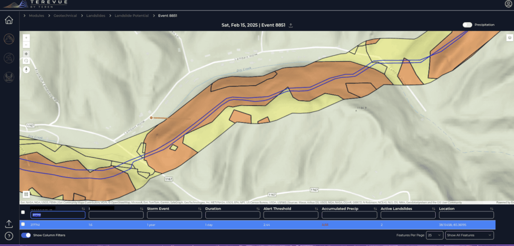
One operator’s experience proved that Terevue can catch the risks no patrol or instrument might see—until it’s too late. The Challenge Pipeline operators face an uphill battle when managing assets in landslide-prone regions. With limited instrumentation like inclinometers, most rely on aerial patrols and historical data to detect potential threats. But with traditional methods, not […]
Strange Bumps in the DTM: How Teren’s LiDAR Analytics Helped A Renewable Energy Investor See the True Terrain
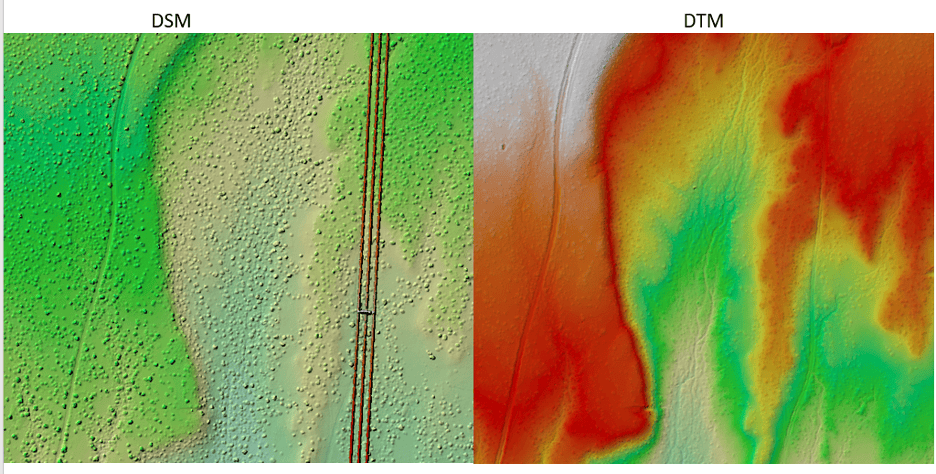
We think there are holes in the digital terrain model. That’s what an engineering firm flagged to Teren’s customer, a renewable energy investor, when they received Teren’s advanced LiDAR and analytics for a project on a solar generation facility out in Southeast New Mexico. Teren’s work with the renewable energy investor started early 2024 to […]
Leveraging Predictive Analytics: Teren’s Practical Impact for Pipeline Operators
Our predictions proved spot-on when heavy rainfall triggered a landslide exactly where Teren had warned in a pipeline right-of-way.
Protecting the Coral Reef in the Wake of the Lahaina Wildfire
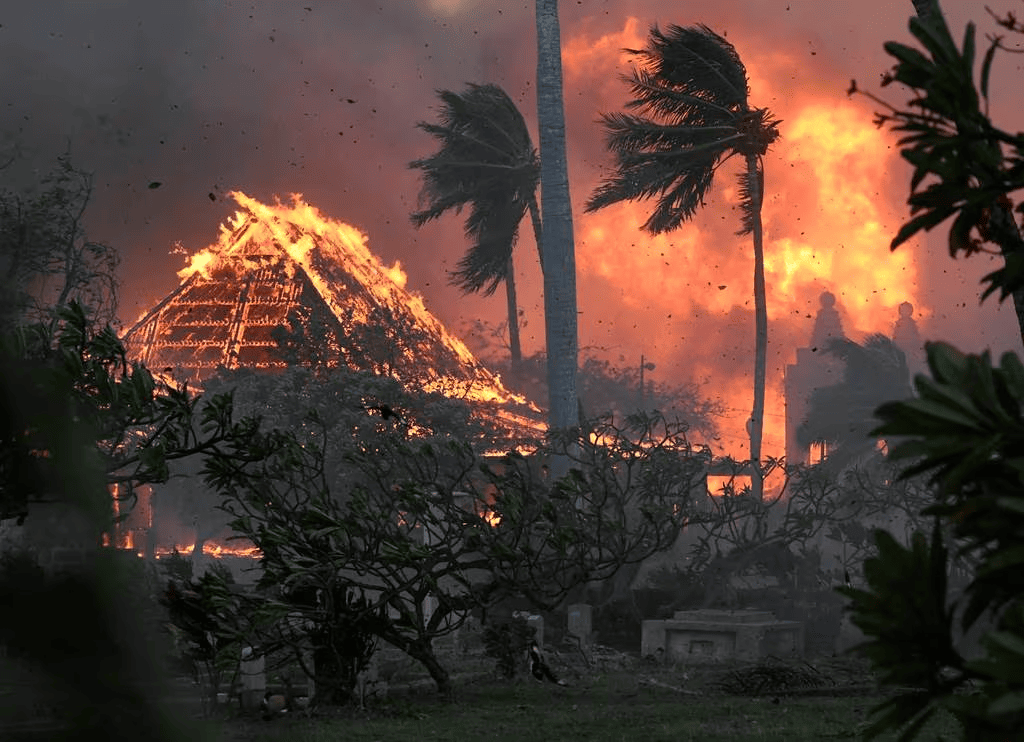
Thanks to Teren’s data, Maui County strides toward preserving its precious coral reefs, ensuring their resilience and long-term health in the wake of the Lahaina fire.
Revolutionizing Post-Wildfire Recovery: A Case Study on Hermits Peak Watershed Management Project

Read Teren’s case study on the Hermits Peak watershed management project completed in collaboration with the USDA.
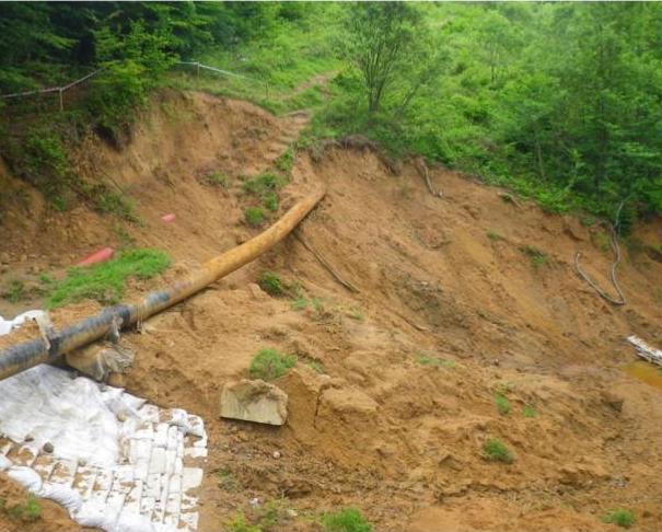
From Reactive to Proactive Pipeline Integrity Management: A Transformation in Appalachia

The Problem: A Hidden Threat to Critical Infrastructure Eight years ago, Bryan Crowe, a Pipeline Operations Manager, found himself in a challenging situation in West Virginia. “I’m standing on top of a pipeline, looking down the right of way,” Crowe recalled, “and one of our pipeline technicians had done a locate and noticed a strange […]
Coupling High-Fidelity Data & Hydrologic Modeling Expertise for Wetland Restoration

Teren’s high-fidelity data and modeling improved the wetland restoration process for mitigation compensatory bank permitting and development.
Enhancing Pipeline Inspection Efficiency in the Midwest through Remotely-Sensed Data: A Case Study

With many miles to inspect and a tight deadline, Teren helped the operator swiftly identify geohazards and develop mitigation strategies.