The Problem
A natural gas transmission operator with assets in the midwest found itself confronted with the task of inspecting a pipeline traversing many miles, diverse terrains and vital waterway crossings. Situated in an area predominantly occupied by agricultural and residential properties, the operator needed to conduct a time-sensitive inspection due to a regulatory requirement.
With many miles to inspect and a tight deadline, the operator needed a way to swiftly identify and report on potential areas of risk in or near its right-of-way.
The Solution
To address the urgent need for efficient and accurate assessment, the operator turned to Teren. Teren’s advanced approach involved capturing high-fidelity LiDAR data and leveraging its asset resilience platform to process, classify and analyze the information swiftly.
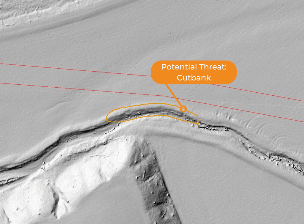
LiDAR captures the topography of the terrain with exceptional accuracy, including subtle changes in elevation and surface features that may not be apparent to field crews conducting visual inspections.
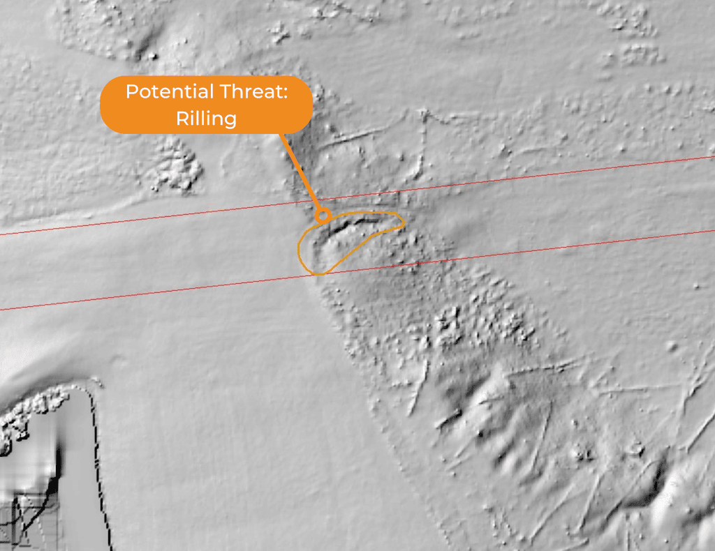
By analyzing the LiDAR data, specialists at Teren were able to identify cutbanks (steep slopes formed by erosion), rilling (small channels created by flowing water), and gullying (larger channels formed by concentrated water flow), which were encroaching upon the right-of-way.
These geohazards, although not easily observable through visual inspection alone, were detectable through the LiDAR-generated point cloud data. The high-resolution measurements allowed for the identification of potential threats to the pipeline’s integrity.
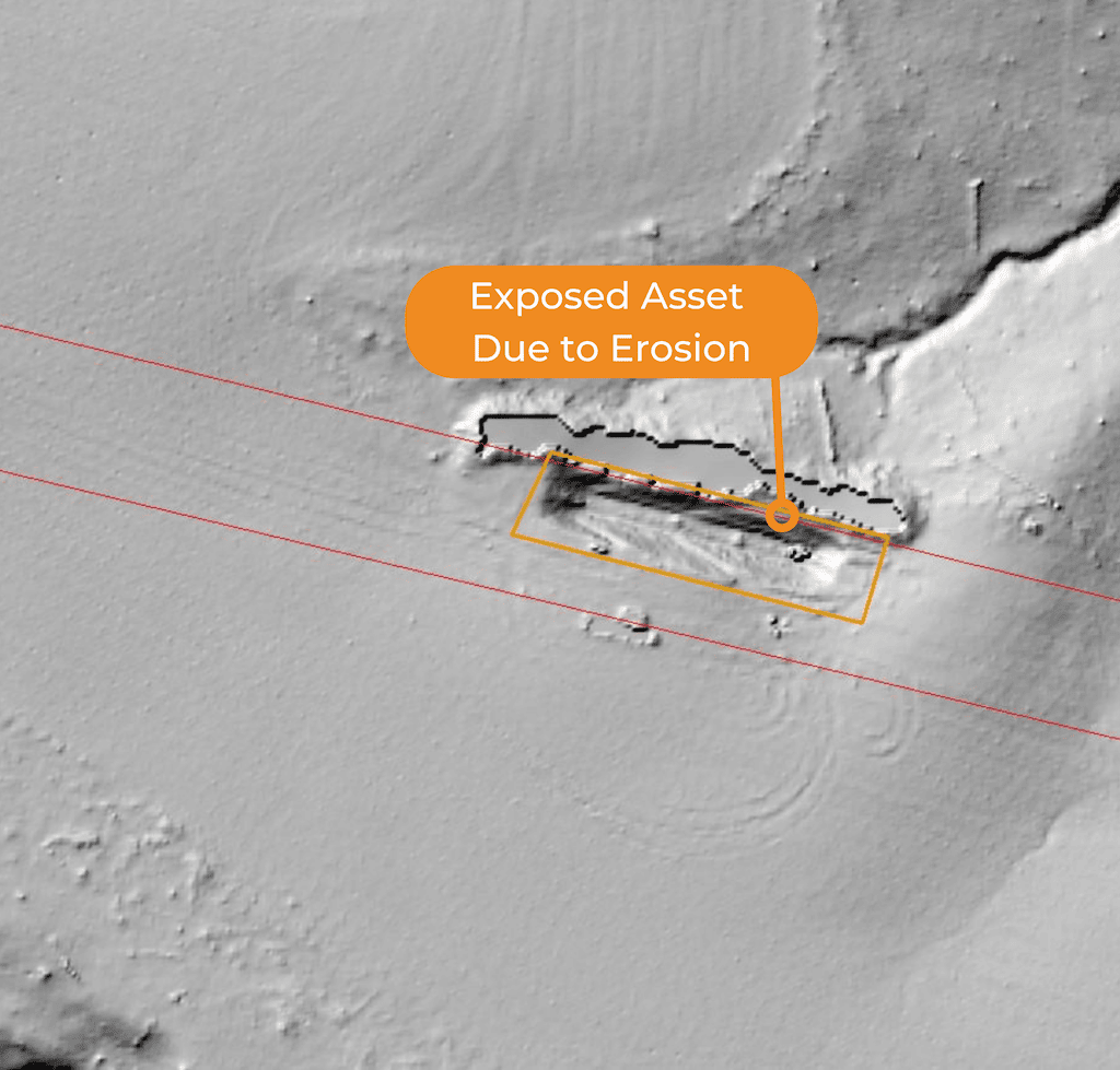
Additionally, the analysis uncovered a significant segment of the pipeline that had become completely exposed due to erosion, highlighting an immediate concern that required prompt attention and remediation. The operator was unaware of the exposed asset and was able to immediately assign a remediation crew.
The Outcome
By leveraging Teren, the operator gained accurate actionable insights at an accelerated pace to meet its deadline.
Unlike traditional methods that could take weeks or even months to obtain raw data, Teren’s platform provided the analytics within days.
By utilizing LiDAR, Teren captured precise terrain data and surface features to identify geohazards that were not visible to field crews. Teren’s powerful processing also played a crucial role in enhancing the accuracy, speed and efficiency of the geohazard assessment.
Teren’s asset resilience platform facilitated efficient and swift decision-making to meet the operators’ requirements and deadline. With this information, the transmission operator can take timely actions to mitigate the risks and ensure the safety and reliability of the infrastructure.
To learn more, visit Teren’s website or book a meeting!