TEREVUE
10 Game-Changing Analytics for Modern Forestry and Land Stewardship
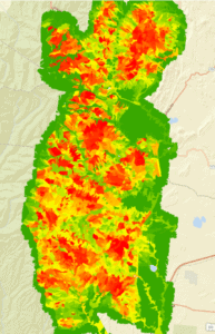
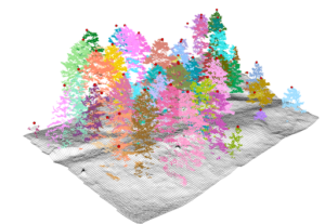
In the ever-evolving field of land and forestry management, the ability to analyze and interpret [...]
08
Oct
Oct
Policy Update: Two Major Legislative Wins for Wildfire Technology & Management
The wildfire management policy landscape is evolving rapidly with two recent significant legislative advancements at [...]
03
Oct
Oct
From Polar Bears to Landslides: A Geomorphologist’s Quest to Solve Nature’s Greatest Mysteries Through Soil
In his 25+ years as a geomorphologist, soil scientist and quantitative spatial ecologist, John Norman [...]
02
Oct
Oct

Introducing Teren’s Bi-Weekly Live Demos: Your Gateway to Advanced Environmental Intelligence
We’re excited to announce the launch of Teren’s bi-weekly live product tours! These live demos [...]
25
Sep
Sep
6 Key Analytics for Insuring Properties in Hazard-Prone Markets
Insuring properties in hazard-prone markets, such as homes located near wildfire risk areas, requires a [...]
20
Sep
Sep
Teren at the Society of American Foresters National Convention: Empowering Conservation with Geospatial Intelligence
We’re excited to announce that Teren will be attending this year’s Society of American Foresters [...]
10
Sep
Sep
Slope Stability Explained, and It’s Relationship with Landslides
Have you ever wondered what makes a grassy hillside stay put instead of sliding down [...]
27
Aug
Aug
These are the top 7 analytics you should be tracking to protect your utilities against the environment
As environmental factors increasingly impact utility infrastructure, integrating advanced environmental analytics into utility providers’ safety [...]
23
Aug
Aug
Fundamentals of Geospatial Data Science (for the Non-scientist)
The article lays out the basics of geospatial data for the non-scientist.
29
Jul
Jul

Denver’s Energy Tech Community: Alive and Thriving
Whoever said energy and tech don’t mix (…guilty?) was mistaken. Teren was invited to pitch at Digital [...]
18
Jul
Jul
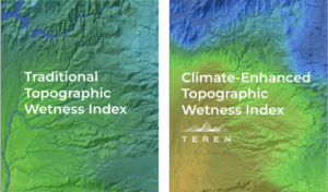
Elevating the Traditional Topographic Wetness Index with Teren’s Climate-Enhanced TWI
What is TWI? The Topographic Wetness Index (TWI) has long been a staple in modeling [...]
16
Jul
Jul

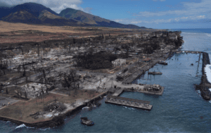
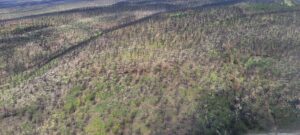
From Fire to Future: Using Spatial Analysis Tools for Wildfire Recovery in New Mexico
Wildfires: Balancing Prevention with Post-Fire Response With the ever-expanding 2024 wildfire season is off to [...]
02
Jul
Jul
Teren Applauds Introduction of Modernizing Wildfire Safety and Prevention Act
Teren commends the introduction of the Modernizing Wildfire Safety and Prevention Act of 2024, a [...]
21
Jun
Jun
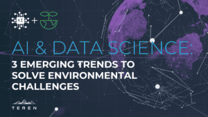
AI and Data Science: 3 Emerging Trends to Solve Environmental Challenges
Discover how AI is revolutionizing data science. Learn how data analysis and insights from AI [...]
11
Jun
Jun
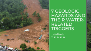
7 geologic hazards and their water-related triggers
Water is a powerful force that shapes our environment and influences a variety of geologic [...]
31
May
May
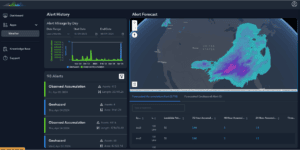
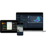
Introducing Terevue: The Future of Environmental Risk Management
Introducing Terevue! Integrate weather data, asset information, and threat-specific analytics into a single, user-friendly interface.
26
Apr
Apr
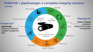
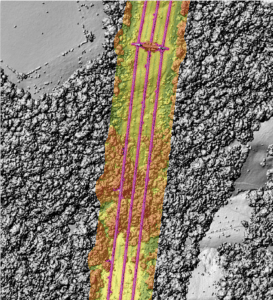
Managing pipeline integrity on the inside and out: Teren and pipelinelogic’s synergistic energy partnership
Preparations for Teren and pipelinelogic‘s shared presence at the upcoming Esri Energy Resources GIS Conference [...]
23
Apr
Apr

Enhancing Pipeline Safety: Integrating Digital Twins and Geohazard Modeling
At PPIM 2024, Teren was part of a collaborative presentation that detailed a groundbreaking approach [...]
21
Mar
Mar
GeoWeek Recap: AI & Machine Learning Opportunities for Geospatial Data
During GeoWeek, our CEO, Toby Kraft, was a guest speaker in the AI and Machine [...]
27
Feb
Feb
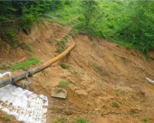
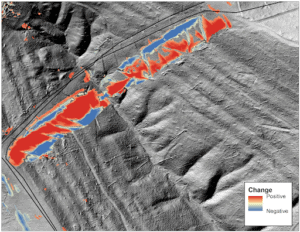
Leveraging Predictive Analytics: Teren’s Practical Impact for Pipeline Operators
Our predictions proved spot-on when heavy rainfall triggered a landslide exactly where Teren had warned [...]
29
Jan
Jan