Water is a powerful force that shapes our environment and influences a variety of geologic hazards. In this article, we delve into 7 geologic hazards and their water-related triggers, exploring how hydrology helps us understand and mitigate these dangers.
What is Hydrology?
Hydrology is the study of water and its movement, distribution, and properties in the environment. It examines the water cycle—precipitation, evaporation, infiltration, and runoff—and its interactions with the landscape and ecosystems. Hydrologists assess rivers, lakes, and groundwater, focusing on water quality and the impact of human activities and climate change. Understanding hydrology helps manage water resources, predict floods and droughts, and ensure sustainable water use.
Why does Water Matter When it Comes to Geohazards?
Water plays a crucial role in geohazards because it significantly influences the stability of the ground and the environment.
Here are 7 water-triggered geohazards explained:
-
Erosion:
Over time, water wears away and transports soil, rocks, and sediment across the landscape. Vegetation removal related to human activities can accelerate this process. -
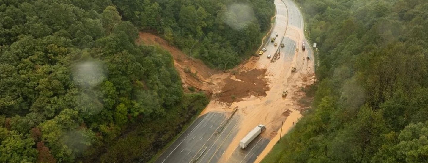
Landslides:
Excess water from heavy rainfall or poor drainage can destabilize soil and rock, leading to landslides and slope failures. Saturated soil loses its cohesion, making slopes more prone to collapse. -
Flooding:
Water from intense rainfall, snowmelt, or storm surges can cause rivers to overflow, leading to flooding. Floods can wash away infrastructure, damage properties, and disrupt communities. -
Groundwater Pressure:
High groundwater levels increase pressure in soil and rock, potentially triggering landslides or sinkholes. Changes in groundwater flow can destabilize foundations and underground structures. -
Soil Liquefaction:
During events like earthquakes, saturated soil can behave like a liquid, causing buildings and structures to sink or tilt. This phenomenon, known as soil liquefaction, poses significant risks in seismic areas. -
River Scouring:
Flowing water in rivers can erode the riverbed and banks, undermining bridges, pipelines, and other structures. This process, known as scouring, can lead to structural failures. -
Karst Formation:
Water can dissolve soluble material such as limestone, forming underground voids and caves. Over time, these voids can collapse, creating subsidence and sinkholes that pose serious hazards to human infrastructure and safety.
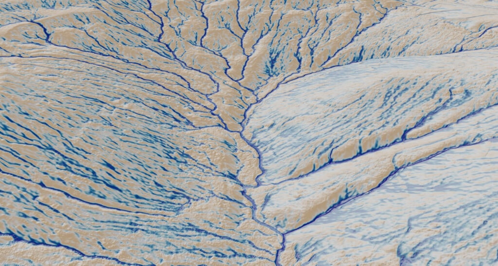
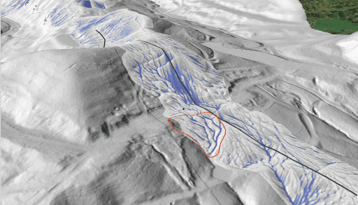
Hydrologic analysis can reveal key hydrologic factors that contribute to the geohazards mentioned above. By analyzing surface water flows, we can pinpoint problematic areas that are likely triggering these hazards.
Here are 4 key hydrologic triggers to watch out for:
-
Accumulation of Surface Water Flow:
Surface water can accumulate and saturate soil, which destabilizes slopes. Controlling these accumulated flows is crucial for geohazard prevention and mitigation. -
Problematic Flow Paths:
Water flowing over steep slopes can carve out problematic flow paths over time. These paths concentrate and accelerate water flow, intensifying the risk of landslides, erosion, and other hazards. Identifying and managing these paths is essential. -
Lack of Stormwater Controls:
Without proper drainage and stormwater diversion in place, intense rain events can overwhelm slopes and trigger landslides and debris flows. Implementing effective stormwater control devices is critical for disaster prevention. -
Significant Weather Events:
While problem areas can exist for years, it often takes a major rainstorm, rapid snowmelt, or other weather event to suddenly activate slope failures. It’s vital to address hydrologic issues before disaster strikes.
Teren’s VP of Product Marketing Kat Kraft breaks these hydrologic triggers down in this video (part of Teren’s recent webinar on Mitigating External Force Threats).
Using Hydrologic Modeling to Get to the Root of the Problem
By uncovering the hidden hydrological factors leading to hazards, we can target prevention and stabilization efforts for greater efficacy. Surface water analysis allows engineers to see the full picture and address the true root causes of geohazards.
Teren uses scenario-based hydrologic modeling and quantification of flow velocities, volume, and depths to understand and mitigate risks associated with flooding, landslides, erosion, & debris flows to help its customers proactively manage their assets, from land to asset management. Learn more here.