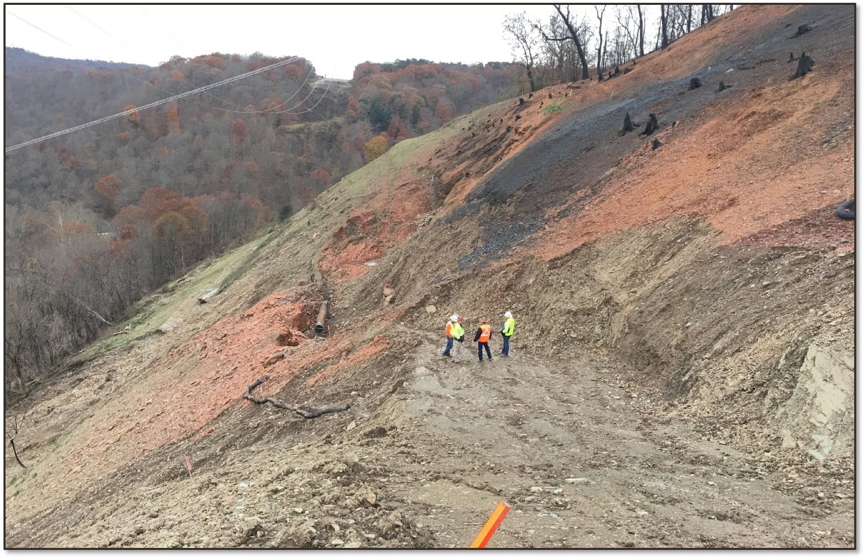
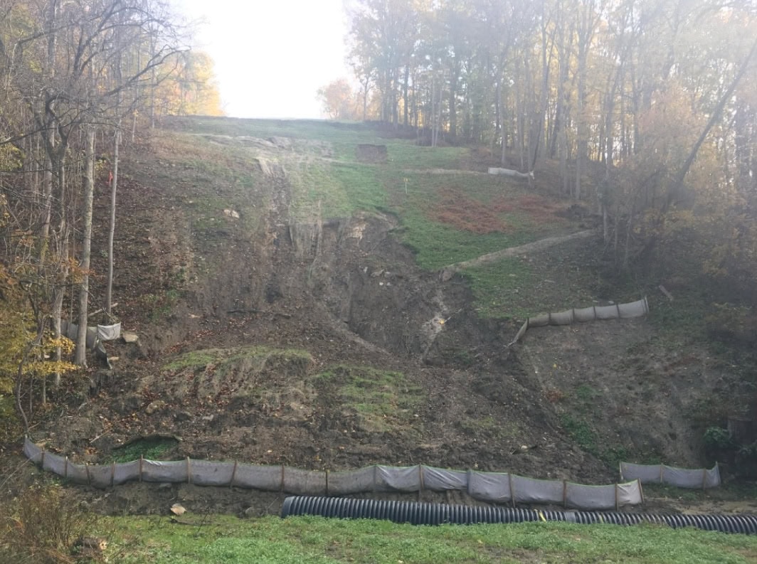
When do landslides actually happen? Not when the slope is steep—but when it’s steep, saturated, and pushed past its tipping point.
 And yet: most landslide models in use today ignore that final push. They tell us where landslides might occur based on slope and soil—but not when. And that omission is what leaves so many operators reacting to slope failures they could have anticipated with the right data.
As weather extremes become more common and rainfall intensity climbs, the need to model real-time landslide susceptibility is no longer optional. It’s foundational to asset safety.
The Problem with Static Landslide Maps
Most public landslide datasets—like those from USGS—were never intended to forecast future events. They’re historical inventories built from scattered studies using inconsistent methods and scales. These maps show where landslides have occurred in the past, not where they’re most likely to happen next.
The limitations are twofold:
- They lack predictive power, because they don’t integrate the environmental conditions that lead to slope failure.
- They overlook active triggers, such as precipitation intensity or soil saturation, that vary daily or even hourly.
This leaves many infrastructure owners in a reactive cycle—responding after a slope moves, rather than preparing for when it’s most likely to happen.
Understanding the Real Drivers of Slope Failure
 Landslides don’t just depend on slope angle. They’re the result of multiple interacting variables:
- Terrain characteristics, like hillslope steepness, shape (centrality), and topographic wetness
- Soil properties, including liquid limit, bulk density, internal friction angle, cohesion, and depth
- Hydrologic loading, especially rainfall that saturates soil and reduces shear strength
- Vegetation and land use, which influence runoff, infiltration, and root reinforcement
Only by combining these factors can a model begin to predict when and where the slope will give way.
What a Predictive Landslide Model Looks Like
Newer approaches to landslide modeling use statistical and machine learning techniques trained on thousands of real-world events. For example, Terevue’s modeling integrates over 13,500 historical USGS-documented landslides with more than 5,000 recent events captured through ongoing monitoring. These are analyzed using covariates such as: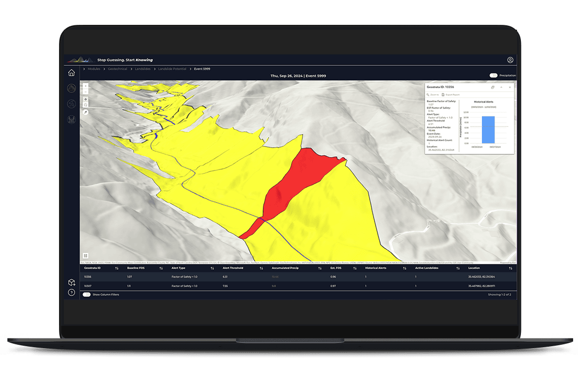
- Topographic wetness index and hillslope centrality, derived from USGS 100-meter elevation data
- Soil infiltration rate and cohesion, extracted from USDA-NRCS STATSGO soil datasets
- Hydrologic energy, modeled by combining terrain with precipitation and runoff characteristics
A random forest analysis then evaluates the contribution of each variable and calculates a probability of future landslide occurrence—not just at a regional level, but at 10-meter resolution.
This kind of model has achieved over 89% correspondence with real-world landslide validation datasets—far exceeding the predictive ability of traditional maps.
Why Timing Matters
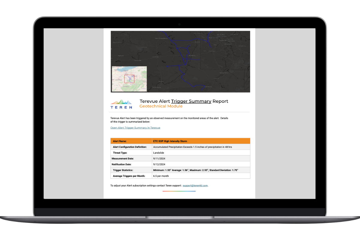
Rain-triggered landslides often occur after thresholds of cumulative rainfall or intensity are crossed—especially in already susceptible areas. Without a model that accounts for weather-informed risk, operators miss key warning windows. They might:
- Fail to inspect slopes after heavy rainfall
- Overlook movement on marginal slopes that appear stable in dry conditions
- Be unprepared for compound threats—like saturated slopes near riverbanks prone to scour
By layering real-time precipitation data on top of susceptibility models, operators gain critical lead time for inspection, mitigation, or alerts to the field.
A Note on Terevue
One such model is integrated into the Geotechnical Module within Terevue, which brings together terrain, soil, hydrology, and rainfall data to identify when and where hillslopes are most likely to move. It builds on the methods above to produce nationwide landslide risk analytics that update as weather changes—allowing operators to shift from reactive response to proactive management.
Final Thought:
Landslide risk doesn’t stop with a steep slope. It starts when that slope becomes saturated, unstable, and invisible—until it moves. The data to forecast these conditions now exists. It’s time our models catch up.