Estimated reading time: 4 minutes
Floods don’t wait for paperwork—and they definitely don’t care about boundaries on a decades-old map.
But across the critical infrastructure industry, many asset managers are still forced to rely on outdated flood tools like FEMA maps and USGS gauges to plan for hydrologic risk.
Here’s why that’s a problem—and what can be done about it.
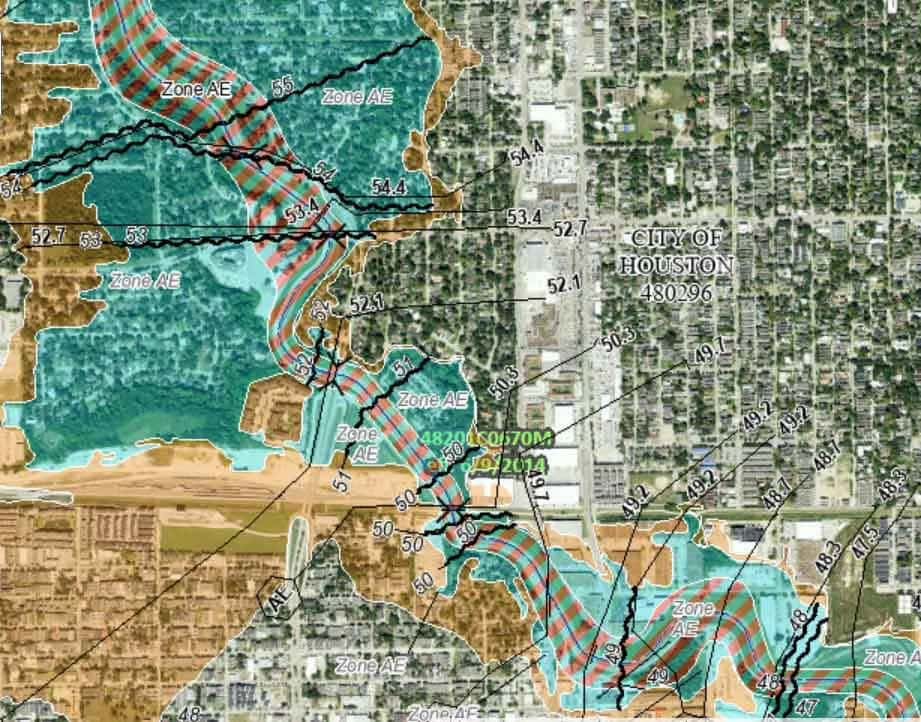
1. FEMA Maps: Built for Regulation, Not Resilience
FEMA flood maps serve a regulatory function—but they fall short when used for operational planning or real-time risk modeling.
Key shortcomings include:
- Outdated Data: Many maps are based on studies from 10+ years ago, ignoring current land use, development, and climate trends.
- Limited Scope: FEMA focuses on riverine and coastal flooding, often neglecting flash floods, smaller tributaries, and localized runoff.
- Low Precision: Maps often lack spatial detail and rely on simplified hydrology, missing critical terrain variations that impact pipeline corridors.
- Static and Reactive: FEMA maps don’t update in real time and don’t integrate climate projections or precipitation forecasts.
- False Confidence: Operators and communities outside mapped zones may underestimate risk, leading to poor preparedness or insurance gaps.
- Coverage Gaps: Rural or unmapped areas—common for pipelines—may be missing entirely.
The takeaway? FEMA maps are a baseline, not a blueprint for resilience.
2. USGS Gauges: Sparse and Site-Limited

USGS stream gauges provide real measurements—but they only capture what’s happening where the gauge is. Many watersheds, especially in remote regions, go completely unmonitored.
If your asset network stretches across rural terrain or into ungauged basins, you’re likely working with large blind spots.
3. Legacy Models Can’t Adapt to Terrain or Forecasts
Traditional hydrologic models often assume uniform terrain or make generalizations about runoff behavior. They don’t account for site-specific conditions like landcover, slope, or soil composition.
Worse, most models don’t incorporate real-time precipitation forecasts, making them poor tools for anticipating threat escalation during storm events.
4. No Alerts. No Insights. No Action.
With traditional tools, there’s no alerting. No predictive analytics. No way to turn a rising river into a clear, actionable threat signal.
Operators are left reacting after the fact, instead of preparing in advance.
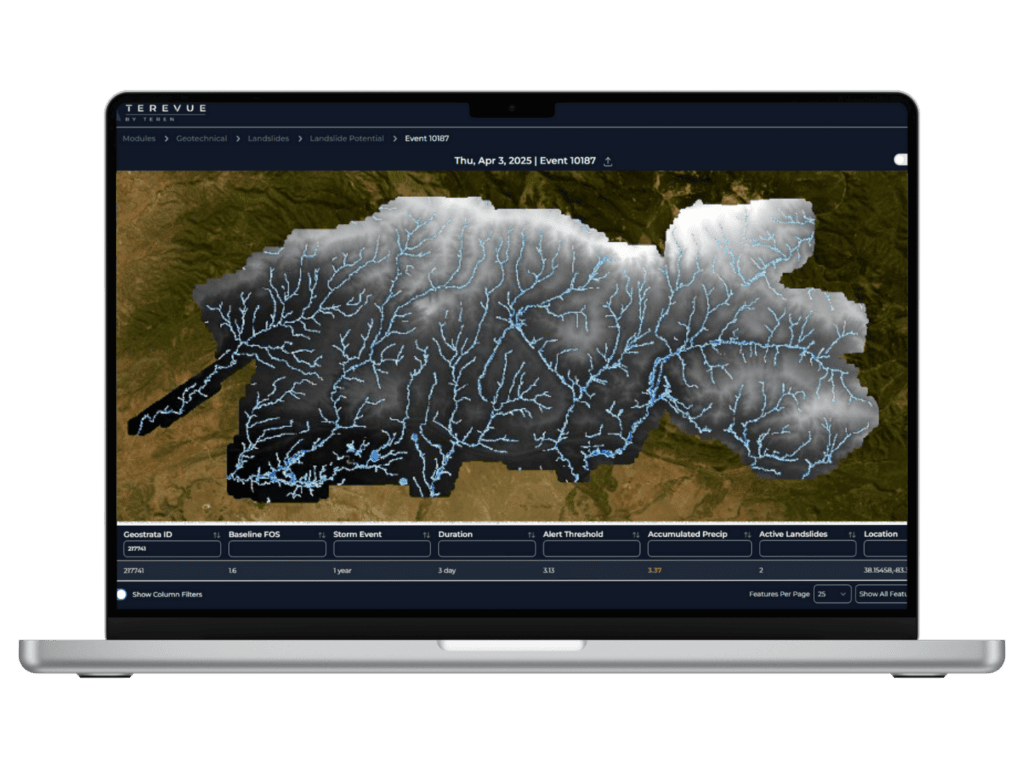
The Future of Flood Risk is Predictive, Not Reactive
Modern flood risk modeling should be:
- Dynamic — continuously updating with weather and terrain changes
- Scalable — covering the full network, not just where sensors happen to be
- Predictive — using machine learning to forecast runoff, streamflow, and threat escalation
- Integrated — working alongside geohazard models for a full situational picture
- Regulatory-aligned — meeting federal (PHMSA, others) mandates for environmental threat surveillance
Don’t Let Your Models Be the Weakest Link
Infrastructure resilience demands better tools. If your flood risk strategy starts and ends with FEMA maps or a few gauges, it’s time to upgrade.
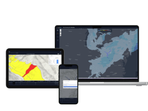
Learn how Terevue’s Hydrotech Module is filling the flood intelligence gap with real-time, terrain-specific, and engineering-ready analytics—built for the unique challenges of pipeline infrastructure.
👉 Book a Demo to see how Hydrotech can help you predict, prioritize, and prevent flood threats—before they become disasters.
How can Teren help you?
We'd love to hear from you.
- Ready to dive deeper? -
Knowledge Hub
White Papers
Webinars