TEREVUE
DECISION-READY DATA AT YOUR FINGERTIPS
LiDAR 4D Content Library
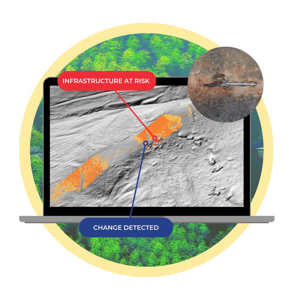
Teren is amassing a content library of remotely-sensed 3D (spatial) data across the United States. That data is updated on regular intervals to monitor changes over time providing a unique 4D (temporal) view. The 4D data library feeds analytics that identify risk, inform mitigation, and strengthen resilience.
Access High-Fidelity Remotely-Sensed Anytime, Anywhere
Teren transforms complex data into actionable insights by combining high-resolution LiDAR and GIS know-how with the latest in machine learning. We deliver via our nationwide content library enabling clients to access high-fidelity data without the hassle and time delays of traditional methods.
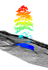
High-Density Point Cloud Data
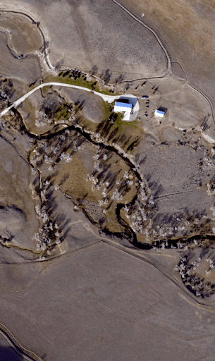
High-Resolution 4-Band Imagery
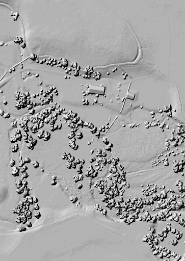
High-Fidelity Digital Surface Model
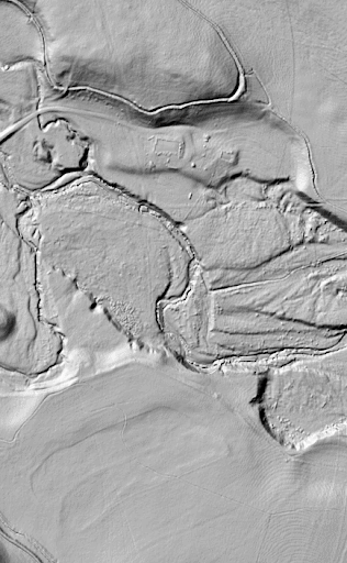
Temporal Digital Terrain Model
More Relevant & Higher Fidelity Data
Before Teren, our engineers relied on publicly available LiDAR data to understand the terrain for new projects. Teren provides us with data just as easily, but with much greater fidelity. Since it’s updated every six months, it is more relevant and true to existing conditions.
Content Region Benefits

Data On-Demand
Teren’s high-fidelity LiDAR data is available immediately. No need to flight plan, schedule crews, or wait for processing. Access data within minutes to keep projects on track.
Decision-Ready Analytics
Teren applies domain expertise and machine learning to deliver objective, repeatable, and accurate analytics to inform asset management decisions.
Simple & Secure Delivery
Teren’s data and analytics are delivered via secure streaming services, integration with existing technology, or data as a download.
Data Retention & Accessibility
Teren provides access to our complete, historical content library to evaluate changes to the environment surrounding your asset over time.
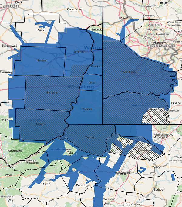
Appalachia Coverage
Where is Teren’s Coverage?
Teren has content regions throughout the United States. We’ve selected areas with volatile and rapidly changing environments, including:
- Appalachia
- Colorado
- Ozark States
- California
By leveraging Teren’s content library, you can reduce exposure to climate threats, measure change over time, and improve physical resilience.
UNDERSTAND YOUR ENVIRONMENTAL THREATS
LiDAR Content Program Saves Clients in Appalachia $152M Annually
Teren’s LiDAR content program saved clients in Appalachia an estimated $152M last year – preventing 24 failures due to landslides and saving roughly 15B cubic feet per day of natural gas.
While landslides are not as pervasive across the United States, companies can apply the premium content program to identify and monitor environment threats more common to their region:
- Gulf Coast – Inundation, Subsidence, Land Movement
- Midwest – Erosion, Flooding, Subsidence
- Rock Mountains – Landslides, Flooding, Wildfire
- West Coast – Wildfires, Land Movement, Flooding