One operator’s experience proved that Terevue can catch the risks no patrol or instrument might see—until it’s too late.
The Challenge
Pipeline operators face an uphill battle when managing assets in landslide-prone regions. With limited instrumentation like inclinometers, most rely on aerial patrols and historical data to detect potential threats. But with traditional methods, not all slope movement is visible—or predictable—until it’s too late.
The Event
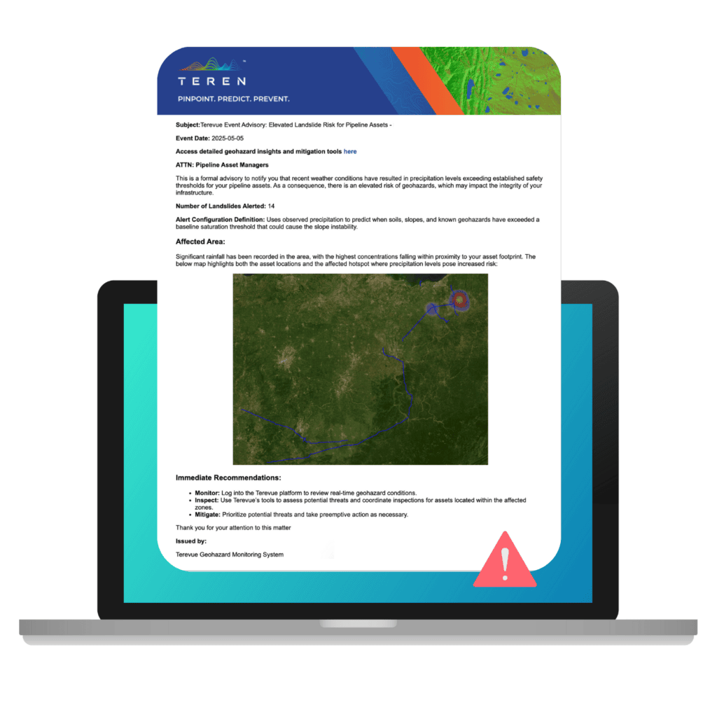
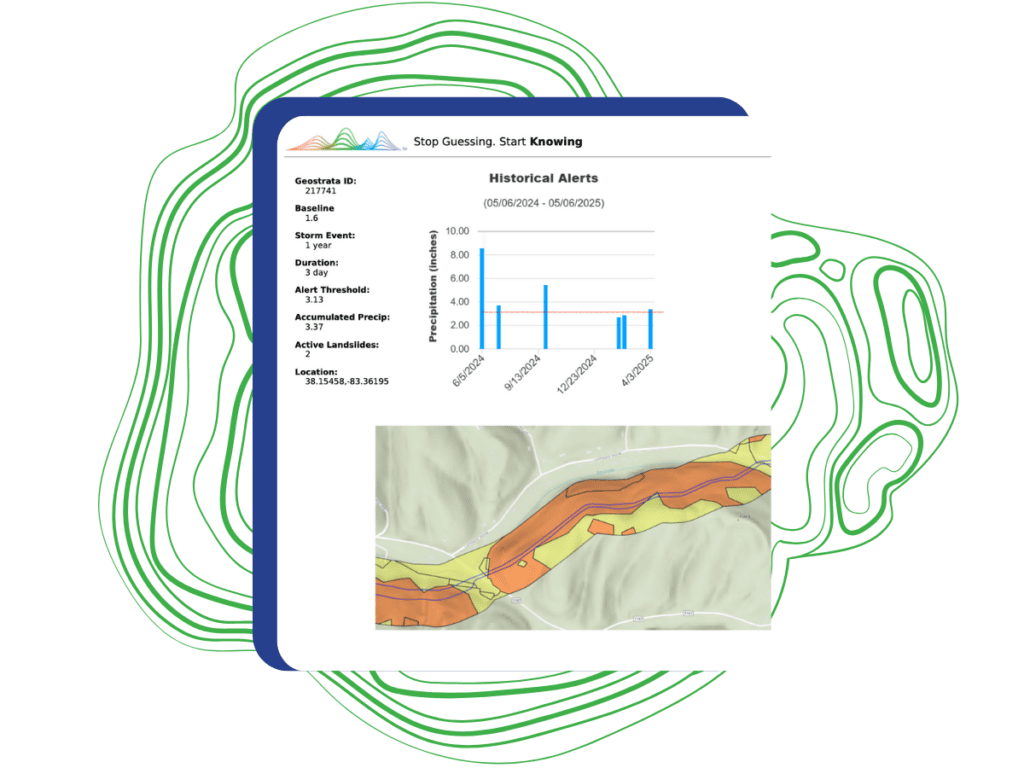
In February 2025, after back-to-back rainstorms, Terevue issued a landslide alert on a section of right-of-way to one of its customers in Appalachia. According to Terevue, the slope had passed its alert threshold (2.44″) with more than 2.85″ of accumulated precipitation. More notably, the alert flagged two active landslides on hill slopes that Terevue predicted to have a high probability of failure.
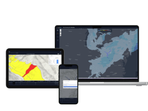
Heading onto the Terevue platform,
the customer could filter down to the specific hill slope in question and observe the event on the right of way.
The Validation
As it happened, the operator had an inclinometer installed at that exact location. Following the alert, they checked the device—and it confirmed movement.
“It was reassuring to see this validation of Terevue on land movement where we happened to have an inclinometer on site. We now know that Terevue could work on areas where we don’t have an inclinometer.”
Terevue by the Numbers
This single-site validation echoed what Terevue has demonstrated at scale. In a broader analysis of nearly 11,000 landslides identified by Teren, 89% would have triggered a Terevue alert at least once based on its precipitation threshold and hazard logic. Even compared against the national USGS landslide inventory—comprising over 13,000 events—Terevue would have successfully alerted on 82% of events.
Why This Matters:
- Validated Modeling: Terevue accurately identified land movement prior to it being confirmed on the ground.
- Confidence Beyond Monitored Sites: The operator gained trust in using Terevue across the rest of their right of way where they don’t have inclinometers on site.
- Signal Over Noise: A second alert two weeks later showed no active movement, helping confirm that the system can tell the difference between real threats and routine weather.
Conclusion
This real-world confirmation proved what Terevue was designed to do: provide pipeline operators with environmental foresight so they can prioritize, act, and protect—before threats evolve into incidents.
Want to see if Terevue would have alerted on past land movement on your right of way? Request a historical lookback analysis and put Terevue to the test.
How can Teren help you?
We'd love to hear from you.
- Ready to dive deeper? -
Knowledge Hub
White Papers
Webinars