The Client
The client is a multinational pipeline transmission operator. Due to confidentiality reasons, the client’s name cannot be disclosed. However, their primary business revolves around operating and maintaining a vast network of transmission pipelines.
The Problem
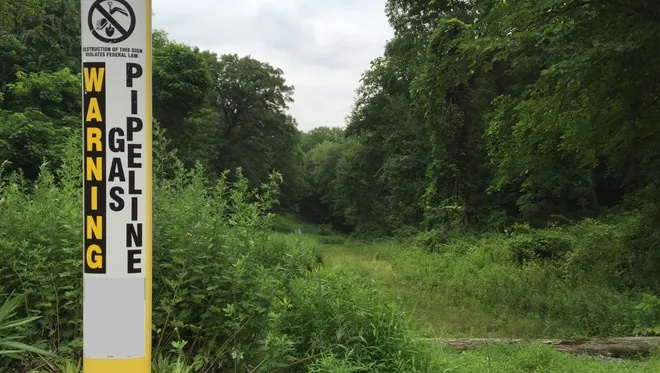
The client’s ROW (Right of Way) maintenance department is responsible for ensuring the visual inspection and access to the pipeline through aerial patrols and field inspections. This maintenance includes activities like mowing, herbicide application, and preventing any encroachments that could obstruct the line of sight for patrols. Compliance with state requirements is mandatory.
The main problem faced by the client is the extensive maintenance required for the thousands of miles of ROW under their management. The acquisition of assets from another entity led to completely overgrown areas, rendering them unsuitable for aerial patrols. Many of these ROWs are decades old and have significant overgrowth due to the geographical location, aging assets, and the scale of the pipeline system.
Previous attempts to address the issue involved using aerial imagery. However, the imagery lacked the necessary classification capabilities to assess the level of “grade” concerning the overgrowth. The grade considers factors such as the area, height, and species of the vegetation. Additionally, compliance with the regulations set by the Pipeline and Hazardous Materials Safety Administration (PHMSA) requires a clear view of the ROW during patrol flights.
Teren’s Solution
Teren proposed a pilot phase using existing LiDAR datasets to deliver vegetation analytics that are specifically tuned to the client’s classifications. During the pilot phase, Teren and the client selected a subset of the pipeline to examine. Teren then developed the following analytics specifically to meet the clients needs, and with a scalable, system-wide implementation in mind:
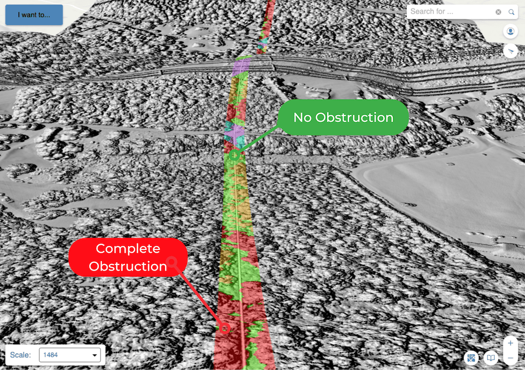
- Grading Obstructions: Teren’s solution identifies the areas of partial and complete obstruction along the pipeline’s ROW. The solution provides a graded classification system to differentiate between various obstruction levels based on land use, such as natural areas, agricultural/residential areas, and urban areas.
- Quantifying Overgrowth: The solution accurately quantifies the amount of vegetation and its specific classes, enabling the client to determine the volume of biomass to be removed. This information is crucial for budgeting tree removal and harvesting operations.
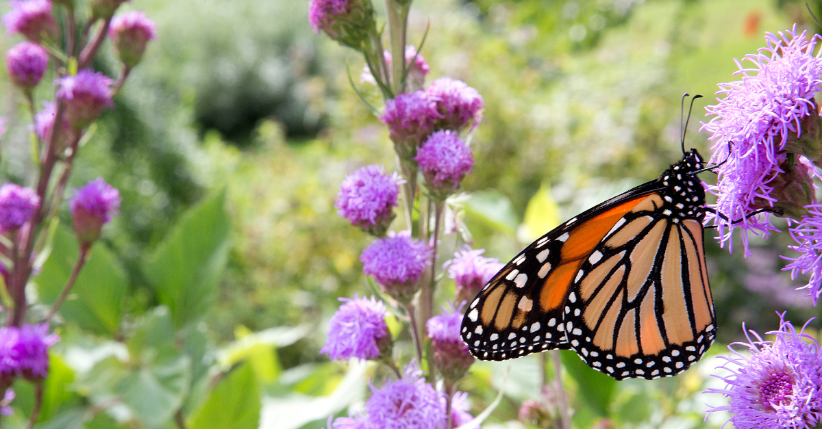
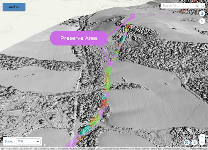
- Monarch Butterfly Habitat Optimization: Teren’s solution identifies natural areas that need to be preserved due to their significance as habitats for the monarch butterfly. By maintaining a bank of areas suitable for development, the client can optimize the ROW while ensuring the protection of monarch butterfly habitats. This involves planting milkweeds and other flower species, which are essential for monarch butterflies.
Teren’s solution stands out from others in addressing this specific problem in the following ways:
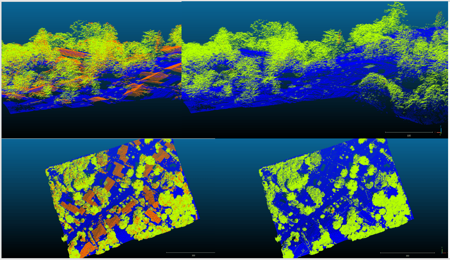
- Leveraging LiDAR and Analytics: Teren utilizes existing LiDAR data from the client’s previous programs, maximizing the value extracted from their investment. LiDAR enables the high-precision needed to examine the overgrowth and Teren’s powerful processing engine scales to thousands of miles of pipeline.
- Identifying Individual Trees: By identifying individual trees across, estimating their size, and understanding the extent of overgrowth, Teren’s solution provides accurate and detailed insights at a large scale.
- Timely Data Delivery: Teren’s ability to process and deliver both visualization tools, such as a 3D viewer, and comprehensive reports enables the client to quickly access the necessary data. This speed and efficiency are crucial for managing extensive geographies and datasets effectively.
The Outcome
The client was highly satisfied with the results achieved during the pilot phase. Not only were they able to identify and prioritize specific areas for ROW maintenance, they were also able to identify the areas that need to be preserved for the endangered Monarch butterfly.
- Summary Statistics: Teren’s solution provided the client with summary statistics, including the number of acres categorized into different grades. This aggregation of data allowed the client to target specific areas for prioritized maintenance and vegetation management.
- Scalable Analytics: Teren successfully worked with the client to develop a scalable analytic solution that addressed their specific requirements. The ability to adapt the solution to the client’s needs was a key factor in achieving successful outcomes.
- Speed & Relevance: The speed of data delivery, particularly for a large geography and datasets, was a significant advantage. The client obtained the required information in a timely manner, allowing them to scale the implementation of the solution across their entire asset footprint.
Moving forward, Teren and the client are planning to implement the solution as a system-wide program. Additionally, discussions are underway regarding future projects that involve species habitat considerations, such as compliance with the Endangered Species Act.
To learn more about Teren’s solutions for pipeline operators, visit our webpage.