BY INDUSTRY
From pre-burn risk assessment through post-burn reclamation, Teren’s wildfire analytics provide critical insights into ground fuels, soil conditions, and hydrology hazards.
Teren leverages remotely-sensed data, environmental twins, and modern data science techniques to accurately evaluate pre- and post-burn conditions to mitigate wildfire risk and prevent further damage in the wake of fire.
Prescribe Proactive Forest Treatments
Teren provides wildfire fuels and risk assessments that inform optimal mitigation treatments for rangelands, forestlands, and pasturelands. Leveraging remotely-sensed data, Teren’s nationwide wildfire model, and extensive earth sciences expertise, we help organizations pinpoint areas of high risk for proactive treatment.
We also equip clients with an understanding of the positive and/or adverse environmental and ecosystem impact from forest treatment and help determine the return on investment.
Request a meetingReclaim Burn Areas & Regenerate Ecosystem Function
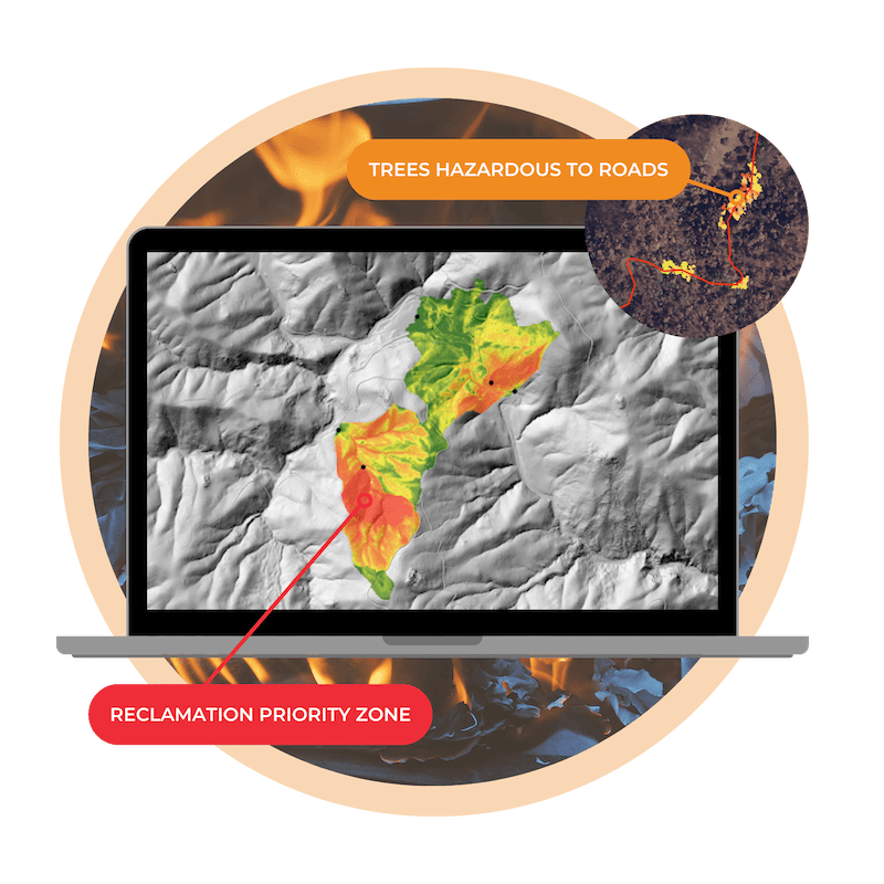
Reveal where action is needed most to protect human lives and infrastructure, prevent further disasters, and regenerate ecosystem function.
- Soil Burn Severity Modeling
- Sedimentation and Debris Flow Hazards Modeling
- Hydrologic Resource Impact Modeling
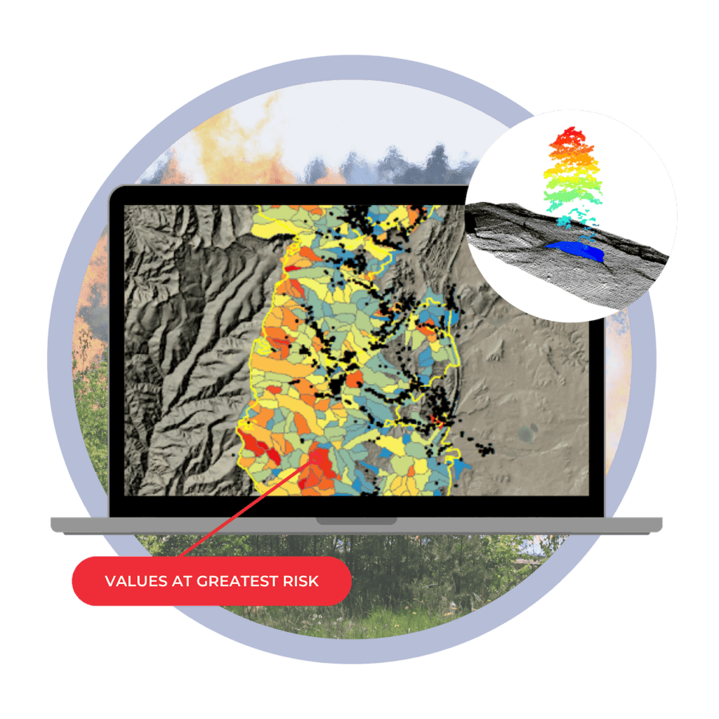
- Values-at-Risk Analysis and Prioritization
- Burn Area Stabilization Prioritization
- Revegetation for Carbon Prioritization
- Reclamation Success Reporting
Teren Analytics for Wildfire Reclamation

Burn Severity & Sediment Impact

Watershed & Debris Flow

Values at Risk Identification

Vegetation Vitality & Mortality
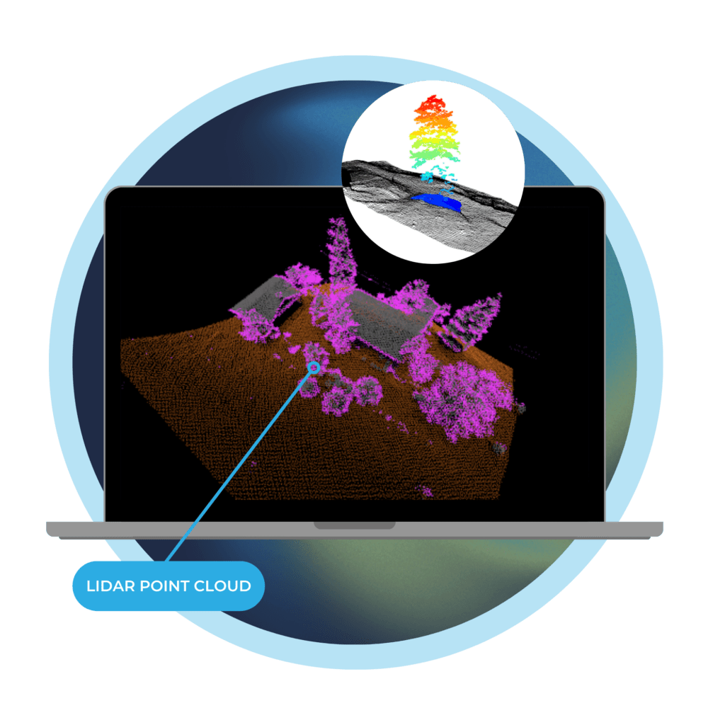
Pinpoint Property-Level Wildfire Fuels
Vegetation removal lowers wildfire risk by 35%.Teren’s vertical spacing analysis color codes individual trees and brush to indicate height and inform decisions.
Our process pinpoints wildfire risk exposure and vulnerabilities so you can prioritize vegetation trimming and removal. With Teren, you can reduce wildfire severity, impact, and endangerment.