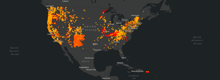
The importance of accurate and reliable LiDAR data cannot be overstated in the early stages of renewable site development. From estimating earthworks to designing array layouts, LiDAR plays a crucial role in determining the viability and success of solar energy projects.
LiDAR’s Role in Renewable Development
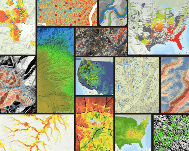
LiDAR (Light Detection and Ranging) technology uses laser pulses to measure distances and generate accurate three-dimensional maps of the Earth’s surface. It provides crucial data for determining earthworks requirements, material needs and even the optimal placement and orientation of solar panels.
By capturing precise elevation and topographic information, LiDAR allows developers to assess factors like shading, slope, and potential obstructions.
But, What Happens When the Data is Poor Quality?
Unfortunately, poor quality LiDAR can occur due to various factors. Common mistakes in collection such as poor ground control, insufficient data density or inadequate scanning patterns can lead to inaccuracies in terrain and vegetation modeling. Poor processing and calibration can introduce errors into the final data sets used by engineering for layout, shading and stormwater planning. And of course, human error is always a risk.
These factors often result in re-flights and change orders, but the costs go beyond the acquisition and can have impacts on the project for years to come.
5 Hidden Costs of Bad LiDAR Data
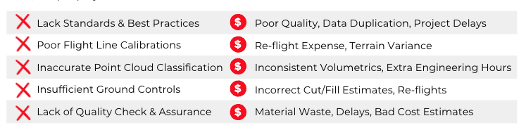
- Overestimation of Cut/Fill and Materials Needed: Poor quality LiDAR data can lead to overestimations of cut/fill volumes, resulting in unnecessary excavation or excessive use of materials. This can lead to increased project costs, inefficient resource utilization, and potential environmental impacts associated with excessive earthwork.
- Regulatory and Permitting Issues: Obtaining accurate data during the early stages of solar farm development is crucial for complying with regulatory requirements and securing the necessary permits. Bad LiDAR data can lead to inaccuracies in reports and applications, potentially leading to delays, rejections, or complications in obtaining the required permits and authorizations. These setbacks can significantly prolong the development timeline and increase project costs.
- Suboptimal Solar Panel Placement: Bad LiDAR data can result in suboptimal placement of solar panels within the farm. Inaccurate information about the topography and elevation of the site can lead to poor positioning decisions, reducing the overall efficiency of the solar array. Panels placed on shaded or uneven terrain may underperform, resulting in decreased energy output and financial losses for the project.
- Increased Maintenance and Operational Costs: Poorly positioned solar panels can also increase maintenance and operational costs in the long run. If panels are placed in areas prone to shading, flooding or where maintenance access is challenging, it can lead to higher cleaning, repair, and monitoring expenses. These additional costs can erode the financial viability of the site, negatively impacting its long-term sustainability.
- Environmental Impact: Poor quality data can result in poor site selection, leading to unintended environmental consequences. For instance, if a solar farm is built on ecologically sensitive land or habitats, it can cause ecological disruption and harm to local biodiversity, undermining the very purpose of transitioning to clean energy sources.
What Can Developers Do to Avoid Bad Data?
To mitigate these risks, it is crucial for renewable developers to work with experienced LiDAR experts, such as Teren, who streamline LiDAR acquisition and ensure the data processing, calibration and classification are rigorous and accurate.
Implementing robust data processing workflows, including appropriate algorithms and quality control checks, can help identify and rectify errors or anomalies in the data. Thorough validation and cross-checking of processed data against ground truth information can help ensure data accuracy, and therefore provide the quality assurance needed to make critical engineering, earthworks, and material decisions to save money across the project lifecycle.
Ready to Learn More?
Head to our renewables page to learn how developers can improve accuracy all while saving time and costs using Teren’s data suite in the early stages site screening. Or, book a demo with one of our experts.